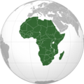
Setshwantsho:550px-Africa (orthographic projection).png
550px-Africa_(orthographic_projection).png (550 × 550 pixels, file size: 111 KB, MIME type: image/png)
Segologolo sa setshwantsho
Tbetsa letsatsi/nako go bone faele jaaka ene e ntse ka nako eo.
| Letsatsi/Nako | Thumbnail | Dikarolwana | Modirisi | Comment | |
|---|---|---|---|---|---|
| ya jaanong | 18:54, 27 Mopitlo 2016 |  | 550 × 550 (111 KB) | Christian Ferrer | Reverted to version as of 08:55, 26 March 2016 (UTC) |
| 18:54, 27 Mopitlo 2016 |  | 550 × 550 (111 KB) | Christian Ferrer | Reverted to version as of 08:55, 26 March 2016 (UTC) | |
| 17:35, 27 Mopitlo 2016 |  | 550 × 550 (107 KB) | Insidema | Reverted to version as of 16:37, 25 March 2016 (UTC) | |
| 10:55, 26 Mopitlo 2016 |  | 550 × 550 (111 KB) | Ankry | Reverted to version as of 23:12, 14 July 2011 (UTC) | |
| 18:37, 25 Mopitlo 2016 |  | 550 × 550 (107 KB) | Hpyounes | update | |
| 01:12, 15 Phukwi 2011 |  | 550 × 550 (111 KB) | OgreBot | (BOT): Reverting to most recent version; originally uploaded at en.wikipedia on 2011-07-09 10:53:33 by Richardprins | |
| 01:12, 15 Phukwi 2011 |  | 550 × 550 (97 KB) | OgreBot | (BOT): Uploading old version of file from en.wikipedia; originally uploaded on 2011-07-09 03:12:36 by RugTimXII | |
| 21:09, 9 Phukwi 2011 |  | 550 × 550 (111 KB) | Wiwi euro | {{Information |Description=Mapa Afryki po oddzieleniu się Sudanu Południowego od Sudanu 9 lipca 2011. |Source=http://upload.wikimedia.org/wikipedia/en/b/b9/550px-Africa_%28orthographic_projection%29.svg |Date=9 lipca 2011 |
Tiriso ya setshwantsho
There are no pages that use this file.
Tiriso ya file ka karetso
Di wiki tse dingwe di dirisa setshwantsho se
- Dirisa mo ast.wikipedia.org
- Dirisa mo bn.wikipedia.org
- Dirisa mo bs.wikipedia.org
- Nogometna reprezentacija Južnoafričke Republike
- Šablon:Afričke nogometne reprezentacije
- Nogometna reprezentacija Alžira
- Nogometna reprezentacija Obale Slonovače
- Nogometna reprezentacija Nigerije
- Nogometna reprezentacija Angole
- Nogometna reprezentacija Toga
- Nogometna reprezentacija Nigera
- Nogometna reprezentacija Kameruna
- Nogometna reprezentacija Gane
- Nogometna reprezentacija Tunisa
- Nogometna reprezentacija Egipta
- Nogometna reprezentacija Senegala
- Nogometna reprezentacija Maroka
- Afrička nogometna konfederacija
- Nogometna reprezentacija Republike Kongo
- Nogometna reprezentacija Malija
- Nogometna reprezentacija Zambije
- Nogometna reprezentacija Ekvatorske Gvineje
- Nogometna reprezentacija Burkine Faso
- Nogometna reprezentacija Zelenortskih Ostrva
- Nogometna reprezentacija Gabona
- Nogometna reprezentacija Gvineje
- Nogometna reprezentacija Demokratske Republike Kongo
- Nogometni savez Ekvatorske Gvineje
- Nogometni savez Gane
- Nogometni savez Republike Kongo
- Nogometni savez Demokratske Republike Kongo
- Nogometni savez Senegala
- Nogometni savez Gvineje
- Nogometni savez Gabona
- Nogometni savez Kameruna
- Nogometni savez Južnoafričke Republike
- Nogometni savez Zelenortskih Ostrva
- Nogometni savez Burkine Faso
- Nogometni savez Obale Slonovače
- Nogometni savez Zambije
- Nogometni savez Malija
- Nogometni savez Tunisa
- Nogometni savez Alžira
- Šablon:Afrički nogometni savezi
- Kategorija:Nacionalni savezi FIFA-e
- Kategorija:Afrički nogometni nacionalni savezi
- Dirisa mo dag.wikipedia.org
- Dirisa mo de.wikipedia.org
View more global usage of this file.
